Fire fighters are suppressing small incidents and prioritizing other larger fires, with those near private property and homes at the top, which includes Wildcat and Section 30 (Railroad) Fires. Two hold over fires were identified in the Whiskey Fire scar and are currently 2 acres or less in size. Many of the smaller fires in the complex are reaching containment and mop-up operations have started. Aircraft is being shared from other near-by Complexes. An Oregon Army National Guard hoist medivac helicopter will be available as a shared resource if needed. The following is a brief summary of the significant fire activity over the fire complex starting from north to south. Smith Fire – 228 acres- bumping against the prepped road used as a containment line, roads have been brushed for containment lines, hoses have been laid. Mule Creek Fire – 900 acres - holding in the current foot print, containment lines are almost complete, fire has burned down to the pavement; the fire slopped over the line and checked by helicopter water drops. 446 Fire – 366 acres - holding and backing in the Beaver Creek area. Big Hamlin Fires – 300 acres - became very active and stayed within the indirect containment lines. Little Applegate Fire – 150 acres - containment line has been constructed on 80% of the fire; on the north side, hand line has been constructed and tied into the cliff rock band on Red Mountain. Wildcat Fire – 285 acres - containment line has been constructed on the west side to the private land on the north, and helicopters are dropping water to assist firefighters. Section 30 (Railroad) Fire – 80 acres - is active, spot fires were located approximately 1,200 feet from the containment line, which have containment line and hose laid to the spots preparing for mop up operations. The unnamed, smaller fires make up the remaining acres. The firefighting resources on the Devil's Knob Complex are also responsible for conducting initial attack operations on the entire Tiller Ranger District. Weather: Tonight, will be mostly clear in the evening, the cloudy after 10:00 pm with a chance of drizzling mist. Minimum temperatures will be near 54 degrees with 100% humidity. Winds will be west 3 – 6 mph with gusts to 10 mph in the evening then becoming light. Air Quality: Smoke levels can change rapidly depending on weather. Check current conditions on the Oregon Smoke Information Blog. See the link above for the website location. Resources: 3–type 1 hotshot crews, 2-type 2 IA crews, 9-type 2 crews, 2-camp crews, 30-engines, 9-dozers, 9-water tenders, 107–overhead; total resources – 500. Evacuations: The Douglas County Sherriff’s Office has determined the following homes will remain under a Level 3 “GO!” Evacuation Notice: All homes on Upper Cow Creek Road with addresses starting at 20039 through 20700, and three residences in the Burnt Creek area. Level 3 “GO!” means: LEAVE IMMEDIATELY! The following homes will remain under a Level 2 “Be Set” Notice: All homes on Upper Cow Creek Road with addresses starting at 18300-20000. Level 2 “Be SET” means: YOU MUST PREPARE TO LEAVE AT A MOMENTS NOTICE. An interactive evacuation map can be found at www.dcso.com/evacuations. Temporary Flight Restrictions: For the safety of the firefighters and aircraft fighting the Devil’s Knob Complex, a temporary flight restriction has been placed over the fire area. Please consult the “Notice to Airman” for specifics. Wildfires are a “No Drone Zone.” Conditions in the forest are very dry. Any spark has a very high probability of starting a new fire so the public is reminded to be extra careful while enjoying the out-of-doors. ”One Less Spark, One Less Wildfire”.
Devils Knob Complex Evening Update for Saturday, Aug 7
Related


Stay up to date
Get new posts from Roseburg Tracker in your inbox.
More Stories

K9 Nike to Retire From Winston Police Department
Winston Police Dog Retires After Eight Years of service.
1 min read
Roseburg Cuts Ribbon on New Outdoor Tennis and Pickleball Facility
Roseburg’s rebuilt outdoor Stewart Park complex is now open with eight tennis courts and 10 pickleball courts.
3 min read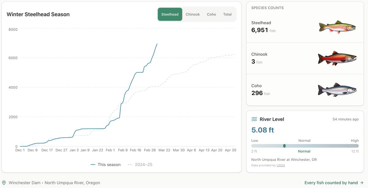
Winter Steelhead Run on the North Umpqua Surpasses Last Year's Total
Nearly 7,000 fish counted at Winchester Dam with two months left in the season
1 min read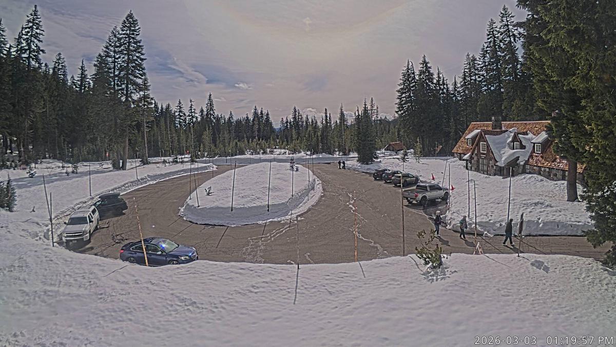
Oregon Faces Challenges After Mild Winter
A mild winter has left Oregon with reduced snowpack heading into spring, raising concerns about river levels and insect activity later this year.
1 min read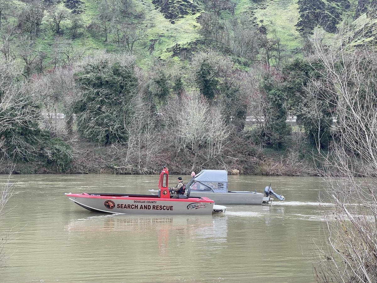
Man Presumed Drowned in South Umpqua River
ROSEBURG, Ore. – A man is presumed drowned following an incident in the South Umpqua River on Friday. On Friday, February 27, 2026, at approximately ...
1 min read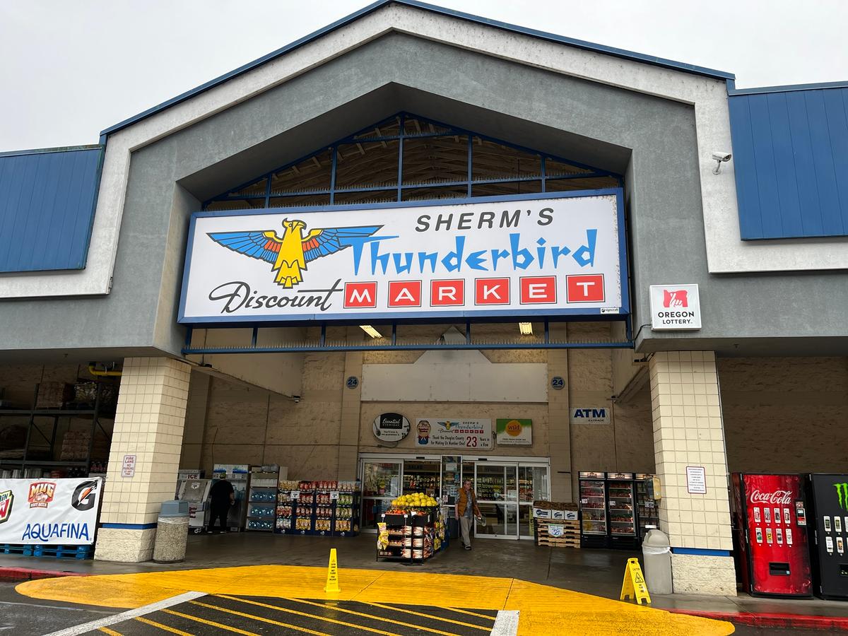
Olsrud Family to Sell Sherm's Markets and Grocery Stores
The Olsrud family, which has owned and operated Sherm's Markets since 1967, is planning to sell the company, including its four Southern Oregon grocer...
2 min read
Stay informed
Get the latest stories from Roseburg Tracker delivered straight to your inbox.