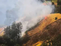
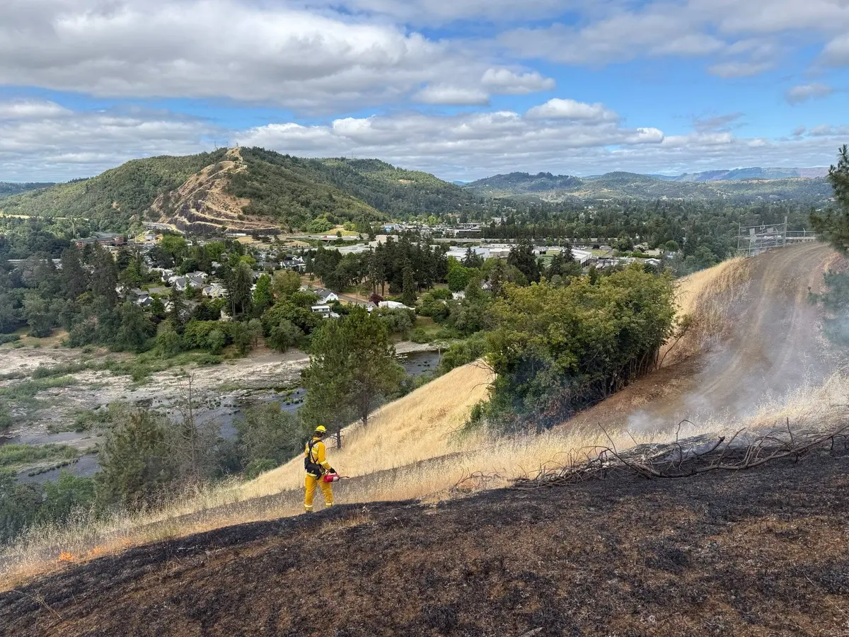
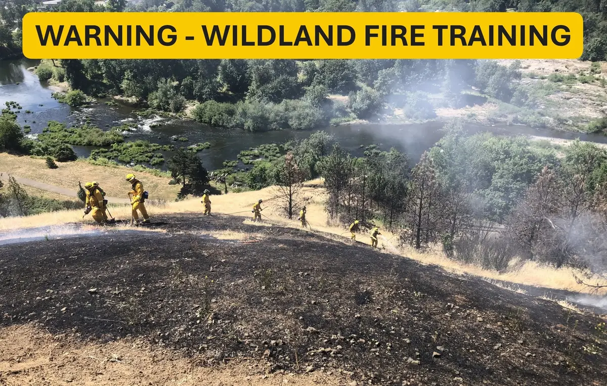
The Jack Creek Fire grew by almost 4k acres Friday and is now 9,333 acres in size. Most of the growth was to the south of the North Umpqua River as the fire jumped the river several days ago. Crews will be working on preventing the fire south of the North Umpqua River from moving east. A burnout was started out to the NE to help hold the fire to the west of that eastern line. You can see that burnout on the fire map out by itself. Lots of structure protection continues to take place. 243 structures are currently threatened. The fire was noted as 10% contained this morning. Here is a video of the Daily Operations Briefing: https://www.roseburgtracker.com/posts/60e9c41eb3e12d000440243c Air Quality Alert In Effect Until 11 am Monday Morning The Oregon Department of Environmental Quality has issued an Air Quality Alert until Monday Morning. * WHAT...High concentration of smoke particulates from the Jack and Bootleg fires. * WHERE...Lake, Klamath, eastern Jackson and eastern Douglas Counties. * WHEN...Until 11 am Monday. * IMPACTS...Smoke can irritate the eyes, lungs and worsen some medical conditions. People most at risk to adverse health effects include infants, young children, people with heart or lung disease, older adults and pregnant women. * ADDITIONAL DETAILS...Smoke levels can change rapidly depending on weather. Check current conditions on the Oregon Smoke Information Blog, DEQs Air Quality Index, or by downloading the free OregonAIR app on your smartphone. Weather: Temperatures are going to reach 94 degrees Saturday, 92 degrees Sunday and 92 degrees on Monday. Temps will finally cool slightly beginning Monday of next week. Still no rain at all in the forecast. Here is the full forecast discussion from the NWS: https://www.wrh.noaa.gov/total_forecast/getprod.php?new&prod=XXXAFDMFR&wfo=mfr Here is the full Jack Creek Fire Morning update from the Northwest Incident Management Team Fire information: The Jack Fire is currently estimated at 9,333 acres and is 10% contained. Fire crews continue to scout and construct primary, alternate, and contingency containment lines around the fire. North of Highway 138E, crews are burning vegetation along containment lines and holding the fire south of Ragged Ridge. Crews are securing lines along Ragged Ridge and continuing to carry those lines to the east. Crews are also securing lines between Dry Creek community and the fire. The Jack Fire is also well-established south of Highway 138E in the 2002 Apple Fire scar. We are actively looking for opportunities to contain the southern side of the fire. Structures: Firefighters will be burning vegetation along lines to increase security around private property in the Dry Creek area. This removal of fuels will help protect the private structures and resources if the main body of the fire approaches this area. Additional OSFM crews will be in the Dry Creek area to provide extra protection. OSFM structural crews will also assess and build defensible space around structures in the Boulder Flats area. Aviation: Yesterday, four Type 1 helicopters and one Type 3 helicopter provided support to ground crews in the afternoon. A strong smoke inversion Friday morning created poor visibility and prevented aircraft from flying until later in the day. Evacuations: All Forest Service campgrounds (Apple Creek, Horseshoe Bend and Eagle Rock) are on Level 3 evacuation GO order. The Dry Creek community as well as all residences on the Illahee Road are also in Level 3 evacuation GO order. Level 2 SET evacuations were issued from mile marker 38 to 43. This includes Steamboat Inn and residences located on Brindle Bug Road, Steelhead Caddis Road, and residences and businesses located between mile post 51 and 55 on Highway 138E. Please visit the Douglas County Sheriff’s Office interactive evacuation map: www.dcso.com/evacuations Closures: State highway 138E from Steamboat Creek to mile post 55 is closed to vehicle traffic. Steamboat Inn is also closed. Oregon Department of Transportation has set an eastside ‘soft closure’ checkpoint at Lemolo Lake junction to allow for local access into nearby recreation areas, including Lemolo Lake. Please visit https://tripcheck.com/ for updates on road closures. The Umpqua National Forest has issued an area closure around the Jack Fire. The full closure order and map can be viewed on InciWeb or at https:// go.usa.gov/xGJSE. Weather: Forecast for near normal temperatures in the 80’s with winds west to northwest.
Jack Creek Fire Doubles in Size Again, Now 9,333 Acres
R
Ryan Finlay
·4 min read


More Stories


Stay informed
Get the latest stories from Roseburg Tracker delivered straight to your inbox.