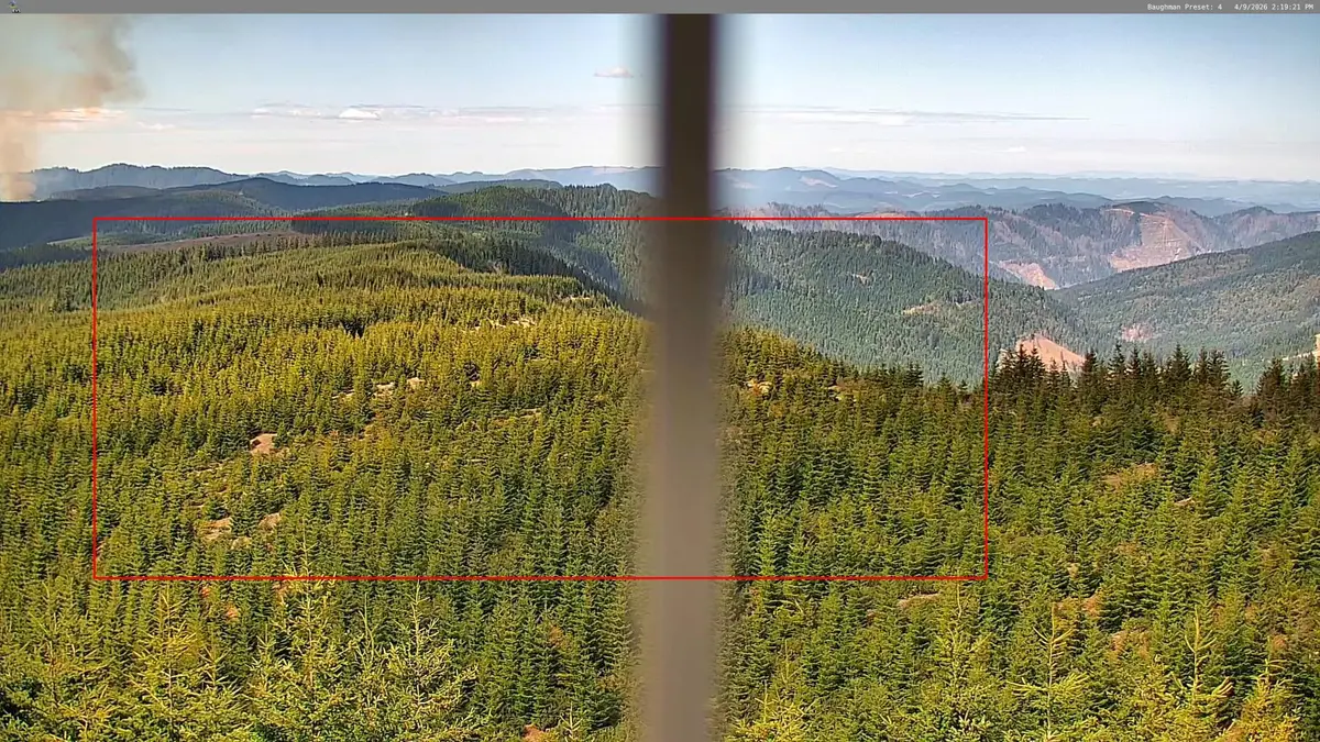
Here is the latest Jack Fire update for Sunday, July 25th. Biggest changes was a good bit of fire movement towards the Twin Lakes area, including a couple of spot fires. Crews are focusing on that area quite a bit Sunday morning. In the images below you can see the location of the fire boundary and where the spot fires are. Fire Information: The fire is currently at 21,503 acres with 57 percent containment. The fire is burning in timber, primarily the understory, with leaf litter and brush. The Jack fire is burning in steep rugged terrain making some areas inaccessible to firefighters and resistant to containment. Fire personnel had another successful day of containing fire activity within control lines north of Hwy 138. Firefighters continue to patrol this area and mop up along containment lines where needed. South of Hwy 138, crews will resume use of mechanical equipment along the eastern flank to reinforce control lines. On the southeast section of the fire, firefighters improved handline within the Twin lakes area and will conduct assessments today to identify possible strategies to strengthen containment lines. Along the west flank of the fire, crews continue to patrol and mop up. Structures: The Dry Creek area and Horseshoe Bend campground will have firefighters patrolling the area to ensure safety of these locations. Aviation: Air support will continue to support ground resources with water, particularly the eastern portion of the fire, to limit the spread of fire. There is a Temporary Flight Restriction (TFR) over the Jack Wildfire to protect aircraft that are involved in the firefighting operation. All aircraft, including drones, are prohibited from flying in the restricted area unless they’re operated by an agency that is involved in the firefighting operation. Please do not fly a drone near the Jack Fire as it is a federal crime to interfere with firefighting aircraft. Safety: We will be continuing to evaluate best management practices for the safety and health of all fire personnel and our community. Various procedures and mitigation measures have been implemented to protect our community and firefighters from COVID-19. We are continually monitoring our staff to ensure the protection measures are effective and in alignment with the primary mission of fire operations. Safety on Hwy 138: Hwy 138 is accessible for all road travel at this time. Please adhere to the speed limit and any posted speed limit changes along Hwy138 as fire traffic will be present in the area. Closures: For your safety and the safety of others, the Umpqua National Forest closure orders remain in effect. The full closure order and map can be viewed at www.fs.usda.gov/umpqua and on the Jack Fire Facebook page. Evacuations: There are no changes to the evacuation levels by the Douglas County Sheriff's Office. A current evacuation map can be found at www.dcso.com/evacuations Weather: Currently there is a temperature inversion over the area. The temperature inversion causes cool air to reside near the surface of the ground while warmer air resides in the atmosphere. This can cause any smoke within the valley to stay and not be released into the upper atmosphere. As the temperatures begin to warm during the day, the air begins to release the smoke trapped by the inversion and a smoke column can form. This can likely occur during today’s forecast as the weather warms up in the afternoon.Today’s weather will continue to be warm. Maximum temperatures are expected in the low 90s with minimum relative humidity at 22 percent. Afternoon winds will be out of the west northwest ranging from 5 to 8 mph with gusts up to 18 mph.
Jack Fire Spots Around Twin Lakes: 57% Contained, 21,503 Acres
R
Ryan Finlay
·3 min read
Related


Stay up to date
Get new posts from Roseburg Tracker in your inbox.
More Stories


Stay informed
Get the latest stories from Roseburg Tracker delivered straight to your inbox.