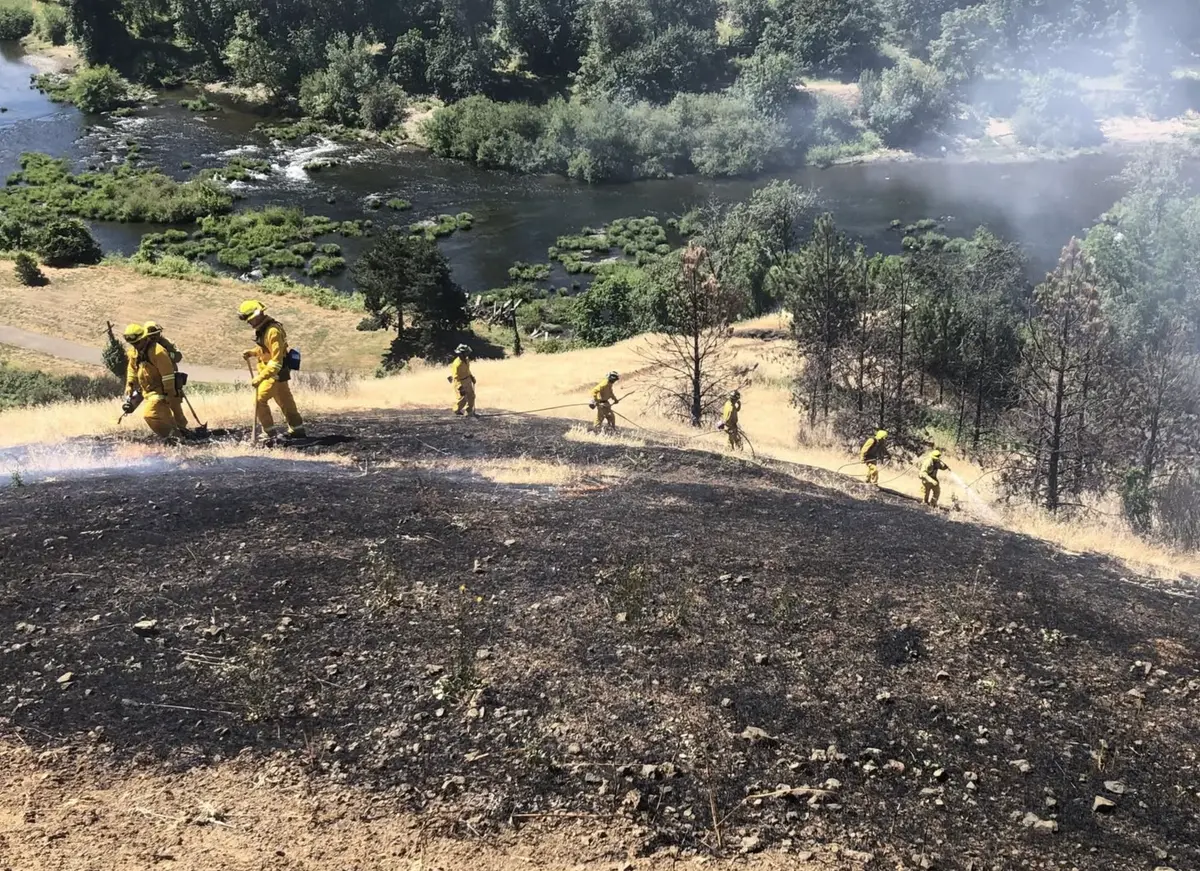
An IR overflight of the Devils Knob Complex has the fires at a combined size of approximately 400 acres as of Thursday morning. The complex is approximately 8 miles east of Azalea. Here is the most recent message from incident command released Wednesday night August 4th: The Devil's Knob Complex is a grouping of 43 lightning caused fires with the majority burning on the Tiller Ranger District, Umpqua National Forest. The fires were started from thunderstorms on July 29th and August 1st. Northwest Incident Management Team 8 has assumed management of these fires at 6 pm this evening. The incident command post is located at the Milo Academy near Tiller, Oregon. General Updates: Fire managers spent the majority of the day connecting with firefighters on the ground and gathering information on each fire to develop a plan of suppression actions. Firefighters continued to make progress on many of the starts. Several fires have continued to grow while other have been lined and mopped-up. Three fires on the upper end of the Forest Service Road 2950 and Bald Ridge area are declared contained. Several fires remain unstaffed due to lack of resources and access. The Wildcat Fire is burning near structures in the Cow Creek drainage and is moving up Red Mountain. This fire is the priority with firefighters working diligently to secure the area and protect these homes. Firefighting resources from Oregon Department of Forestry, Douglas Forest Protection Association, and RogueRiver-Siskiyou National Forest have been providing assistance to local and contracted resources. Weather: Critical fire weather conditions are expected over the next few days before conditions stabilize Friday into the weekend. Tonight the sky will be mostly clear with minimum temperatures between 50-60 degrees with a maximum humidity of 65-80%. Winds will be northwest 5-10 miles per with gusts up to 20 mph in the evening. Evacuations: The Douglas County Sherriff’s Office has determined the following homes are under a Level 3 “GO!” Evacuation Notice: All homes on Upper Cow Creek Road with addresses starting at 20039 through 20700. Level 3 “GO!” means: LEAVE IMMEDIATELY! Danger to your area is current or imminent and you should evacuate immediately. If you choose to ignore this advisement, you must understand that emergency services may not be able to assist you further. DO NOT delay leaving to gather any belongings or make efforts to protect your home or any structure. THIS WILL BE THE LAST NOTICE YOU RECEIVE. The following homes are under a Level 2 “Be Set” Notice: All homes on Upper Cow Creek Road with addresses starting at 18300-20000. Level 2 “Be SET” means: YOU MUST PREPARE TO LEAVE AT A MOMENTS NOTICE. This level indicates there is significant danger to your area, and residents should either voluntarily relocate to a shelter or with family/friends outside of the affected area, or if choosing to remain, to be ready to evacuate at a moment's notice. Residents MAY have time to gather necessary items, but doing so is at their own risk. THIS MAY BE THE ONLY NOTICE YOU RECEIVE. Emergency services cannot guarantee that they will be able to notify you if conditions rapidly deteriorate. An interactive evacuation map can be found at www.dcso.com/evacuations.
Devils Knob Complex Grows to 400 Acres
R
Ryan Finlay
·3 min read

More Stories


Stay informed
Get the latest stories from Roseburg Tracker delivered straight to your inbox.