We are expecting mostly tranquil, seasonable weather over the next few days (through the holiday weekend) with some sunshine, cold mornings and little or no precipitation. Things will change significantly at the start of the new work week (next Tuesday, Feb 21). A sharp cold front will move through Tuesday with gusty winds, rain and heavy mountain snow. Snow levels will lower from 5000 feet down to 2500 feet. Another Arctic air mass will move in behind the front with snow levels lowering down to west side valley floors Tuesday night into Wednesday. This will bring the potential for more low elevation snow west of the Cascades. Confidence is high that this change will occur, but specific timing and snow accumulation details are uncertain. Travel disruptions are likely in the mountains and could be moderate to high impact, especially if significant snow accumulations reach the west side valleys and passes along I-5. Keep checking the latest forecasts for updated information regarding this potential return of winter weather next week! Via NWS in Medford
Another Winter Storm Likely to Arrive Next Week
Related


Stay up to date
Get new posts from Roseburg Tracker in your inbox.
More Stories

K9 Nike to Retire From Winston Police Department
Winston Police Dog Retires After Eight Years of service.
1 min read
Roseburg Cuts Ribbon on New Outdoor Tennis and Pickleball Facility
Roseburg’s rebuilt outdoor Stewart Park complex is now open with eight tennis courts and 10 pickleball courts.
3 min read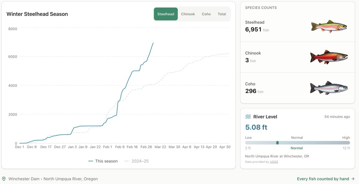
Winter Steelhead Run on the North Umpqua Surpasses Last Year's Total
Nearly 7,000 fish counted at Winchester Dam with two months left in the season
1 min read
Oregon Faces Challenges After Mild Winter
A mild winter has left Oregon with reduced snowpack heading into spring, raising concerns about river levels and insect activity later this year.
1 min read
Man Presumed Drowned in South Umpqua River
ROSEBURG, Ore. – A man is presumed drowned following an incident in the South Umpqua River on Friday. On Friday, February 27, 2026, at approximately ...
1 min read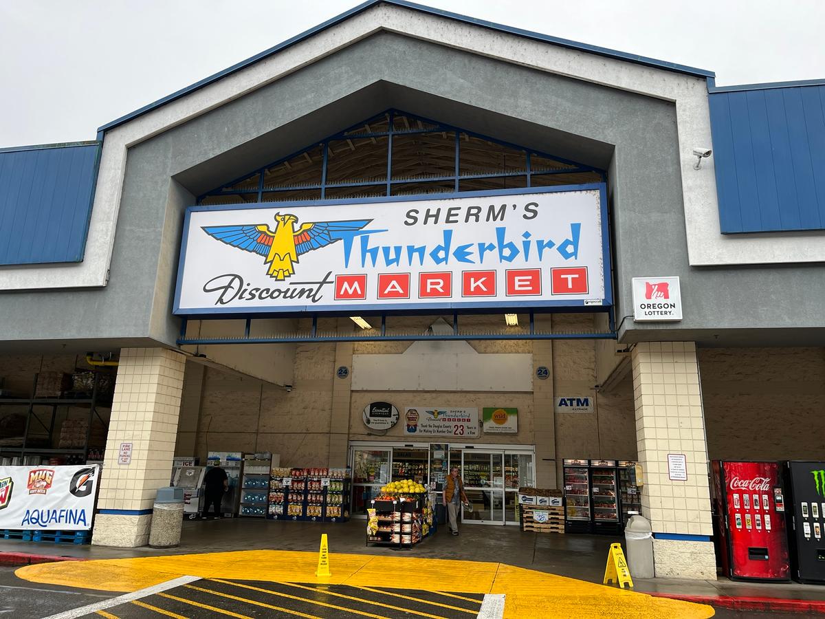
Olsrud Family to Sell Sherm's Markets and Grocery Stores
The Olsrud family, which has owned and operated Sherm's Markets since 1967, is planning to sell the company, including its four Southern Oregon grocer...
2 min read
Stay informed
Get the latest stories from Roseburg Tracker delivered straight to your inbox.